June 25, 2026
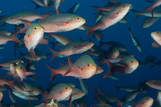
Scientists are working to understand how fish use the banks and reefs of Flower Garden Banks National Marine Sanctuary, located 80 to 125 miles off the coasts of Texas and Louisiana. Current information is sparse, compromising efforts to effectively protect habitats that many fish, including commercially valuable species, depend on for their survival.
The researchers developed a video that describes how they are using acoustic technology to track fish movements and study fish behavior. The video also shares some of the team’s findings to date. For example, the invasive red lionfish, gray snapper, and graysby all use the same habitat but at different times of the day, which may help decrease competition for important resources.
Understanding how and when fish use different habitats is critical to informing management decisions. Project findings will help sanctuary managers design and implement measures that help protect commercial and recreational fisheries in the region.
The project is funded by NCCOS and led by Texas A&M University. The video was produced by collaborators at Mississippi State University’s Marine Fish Ecology group.
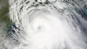
Since 1851, a total of 91 storms have come within 70 miles of East Flower Garden, West Flower Garden, and Stetson Banks. Throughout the years, each hurricane has been unique in its impact on the sanctuary.
|
|